SixthSense
2016
Interdisziplinary project of the Weißensee Kunsthochschule-Berlin and the Freie Universität Berlin
In collaboration with Dominik Ganghofer
Supervised by Prof. Carola Zwick
Supervised by Prof. Carola Zwick
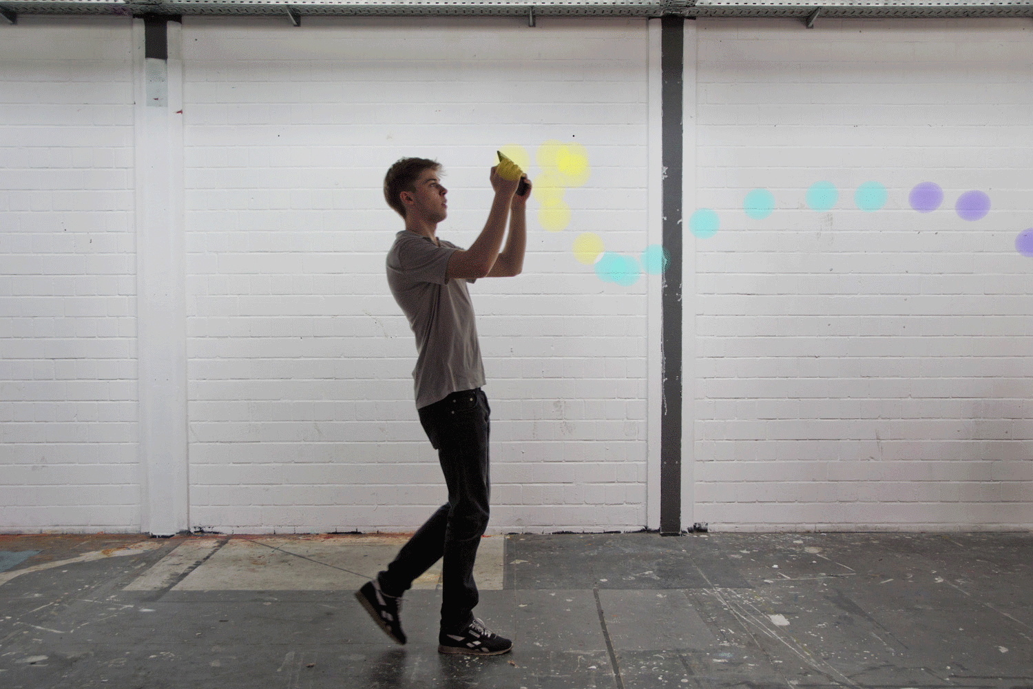
Everything goes wireless. We permanently use electromagnetic waves to communicate, for example, cellular, wifi or radio. While it is essential for us to have cellular signal we have little imagination of the electromagnetic fields that surround us and that we interact with on a daily basis. Could these be visualized to extend our perception?
One could use the created maps to understand the mobile signal distribution in an apartment. Network administrators could visually analyze different WiFi-Networks and how they overlap in spaces. Individual devices like the range of a bluetooth speaker could be visualized. A person sensitive to radiation could try to find a safe place to put the bed. In an educational context magnetic fields do not have to be explained through iron shavings but through three dimensional vectors of the field.
One could use the created maps to understand the mobile signal distribution in an apartment. Network administrators could visually analyze different WiFi-Networks and how they overlap in spaces. Individual devices like the range of a bluetooth speaker could be visualized. A person sensitive to radiation could try to find a safe place to put the bed. In an educational context magnetic fields do not have to be explained through iron shavings but through three dimensional vectors of the field.
With more and more connected devices being introduced we expect a variety of possible data sources for our maps in the near future. The process of active measuring becomes less important since more and more data will be available. In public spaces or shopping malls shop owners could offer information to their customers. A cafe will let you know where you can connect to their network. The tools becomes less of a sensor and more like a window into the invisible layers of space.

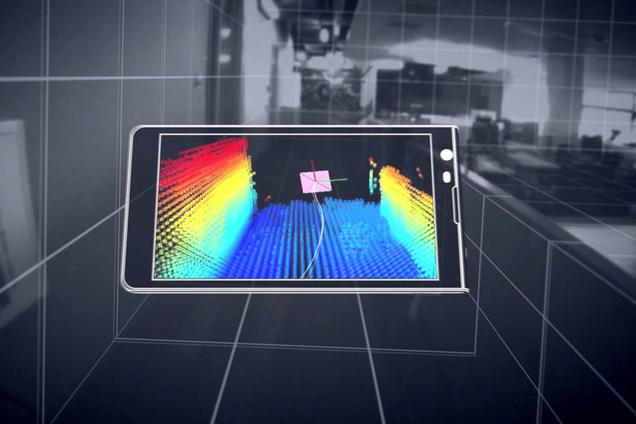
Many mobile and stationary devices have sensors that measure electromagnetic fields along other things. In near future those devices will be able to localize themselves in three-dimensionalspace. Google‘s Project Tango is an example of such a technology. We used a Tango Tablet to create a tool that can measure signals and create a representation of the measured values at their location in augmented reality. While the tablet is moved through space the user creates a threedimensional map of the field. Through the device one can analyze the map and get an understanding of the surrounding radiation. The measured data can be stored and shared with other users. Multiple devices can constantly collect data while they are being used for other purposes – imagine a robotic vacuum mapping the Wifi signal on the go.